Villarrica (Villarrica)
 |
 |
Villarrica has many places that honor the Paraguayan culture, such as the monument to the memory of Manuel Ortiz Guerrero, honorary citizen of the city. About this city Bacón Duarte Prado (journalist and musician) wrote: Villarrica is the city of the eternal youth, born from the waters of the Ycuá Pytá and the breeze that comes from the hills.
Founded by the Spanish Ruy Diaz de Melgarejo, 350 km east from the Saltos del Guaira, on May 14, 1570, with the name Villa Rica del Espíritu Santo (Villa Rica of the Holy Spirit), finally settled in 1682 in the hills near the Ybytyruzu, part of the Caaguazú Cordillera, 180 m above ocean level.
The city is located near the Ybyturuzú, part of the Caaguazú mountain chain. The land is elevated, rough and wooded, appropriate for the cultivating sugar cane, trees for wood and for raising cattle.
In the 16th century, Ruy Díaz de Melgarejo left Ciudad Real with 40 men and 53 horses to the East, where they expected to find mines of gold and silver. After arriving in the lands of Cacique (Chief) Cuaracyberá, he founded a new town on May 14, 1570, and named it Villa Rica del Espíritu Santo, because of the belief that there was abundant gold and silver in the area, and because the timing was near the religious festival Espíritu Santo. Due to constant invasions by Paulist Bandeirantes, the city had to be moved seven times before settling in one place. For this reason it received the name of “Wandering city”.
In 1592, Ruy Díaz de Guzman moved the city 100 km east. In 1599, he moved it again, this time near the Mboteitei River, 100 leagues from Asunción. After long years of peaceful existence, the city was invaded in 1632 by the Mamelucos, and after 4 years of pilgrimage the population settled in the nearby Mbaracayú. Two years later, the Governor Valderrama determined to situate it in the fields of Yarú. In 1642, the population migrated again to Curuguaty.
In 1678, the population settled close to the Tobatyry River, a place called “Espinillo”, but the soil was no good for agriculture so many people decided to organize and do a recognition expedition to the area beyond the Tebicuary River. They found fertile land near Ybyturuzú, so they requested the Governor's authorization to move the city there. On May 25, 1682, he gave licence to establish in Ybyturuzú, only if the King approved it too, which he did on May 14, 1701. This date became the definite date of foundation. The Franciscan Missioners helped consolidate the city, founding a Guaraní Mission in Itapé.
In 1906, the fourth department of Paraguay was formed, comprising Villarrica, Itapé, Hiaty, Mbocayaty and Yataity. During the 20th century, exploitation of the wood in Caaguazú and the importance of Villarrica as an urban center spurred the creation of a railway crossing the entire department from east to west.
Map - Villarrica (Villarrica)
Map
Country - Paraguay
 |
 |
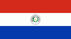
| Flag of Paraguay | |
Spanish conquistadores arrived in 1524, and in 1537 established the city of Asunción, the first capital of the Governorate of the Río de la Plata. During the 17th century, Paraguay was the center of Jesuit missions, where the native Guaraní people were converted to Christianity and introduced to European culture. After the expulsion of the Jesuits from Spanish territories in 1767, Paraguay increasingly became a peripheral colony, with few urban centers and settlers. Following independence from Spain in the early 19th century, Paraguay was ruled by a series of authoritarian governments characterized by nationalist, isolationist and protectionist policies. This period ended with the disastrous Paraguayan War (1864–70), during which the country lost half its prewar population and around 25–33% of its territory to the Triple Alliance of Argentina, Brazil and Uruguay. In the 20th century, Paraguay faced another major international conflict—the Chaco War (1932–35) against Bolivia—in which it prevailed. Afterwards, the country came under a succession of military dictators, culminating in the 35-year regime of Alfredo Stroessner, which lasted until his overthrow in 1989 by an internal military coup. This marked the beginning of Paraguay's democratic era, which continues to this day.
Currency / Language
| ISO | Currency | Symbol | Significant figures |
|---|---|---|---|
| PYG | Paraguayan guaranà | ₲ | 0 |
| ISO | Language |
|---|---|
| GN | Guarani language |
| ES | Spanish language |


